Business Driver
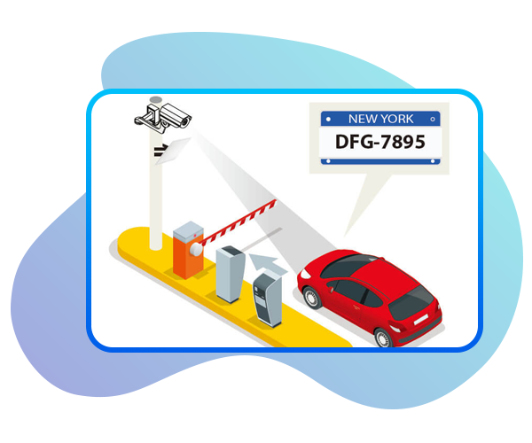
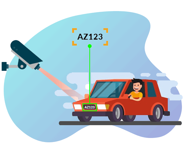
- The objective is to develop a web-based IoT-GIS application that integrates incidents data from live feeds captured from Cameras (IoT based) and Automated Number Plate Recognition systems
- The department plans to setup AI systems to monitor traffic patterns using the feeds from installed cameras and ANPR datasets
Solution
- Proposed a simple web based viewer/application as a solution
- See camera alerts
- Select a camera and display the video feed of the selected camera
- View attributes of that selected camera
- The police departmental users will be provided with the capability to Create, update and delete GIS datasets
- Web and Mobile solution